Our History
Applied Data Consultants (ADC)
A rich history of software consulting that drives our customer-centric approach to last-mile solutions

Software Consulting Since 1996
Two GIS professionals founded ADC in 1996 with the sole purpose of helping clients solve their problems using spatial technologies. Nearly thirty years and countless solutions later, we have evolved our focus beyond GIS to last-mile logistics and software development.
As our expertise and interests expanded, so did our notoriety in the marketplace. This led to our acquisition by Epicor Software in November, 2024. The strategic acquisition integrated our Elite EXTRA last mile logistics suite into Epicor’s enterprise offerings and paved the future of the ADC/Elite EXTRA organization.
Though this marked the end of the Applied Data Consultants (ADC) brand and consulting services, our customer-centric legacy and culture lives on through our Elite EXTRA software suite.
Historical Project Highlights
Through our history, ADC was involved in a wide variety of software development projects that range from warehouse and inventory management, commercial real estate and comparable reports, route selections for direct mail marketing, and driver management systems for the trucking industry. Along with that, we’ve built larger applications that have experienced long-term use by the WI-DNR, WI-DHS and the USACE. Our position on the leading edge of software development technologies has allowed us to provide winning solutions for an assortment of needs.

DQMConnect
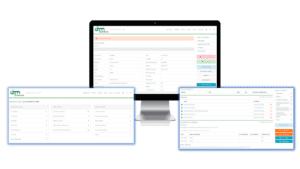
ADC worked with California-based VLC (Vehicle Licensing Consultants) to develop a solution for Driver Management. This web software smoothly covers the complete process of handling driver applications through the hiring process for both drivers and the companies who use it.

REDIComps
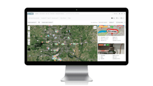
Centered on commercial real estate transactions in the midwest, REDIComps has been using applications built by ADC for close to 20 years. These solutions include detailed comp reports, map and form-based searching, live market data for research, and more

OneBrand Marketing
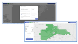
This mail marketing company out of Florida has worked with ADC to build a mapping application that allows for the selection and generation of mailing lists based on carrier routes, zip codes, and demographics nationwide.

PQS
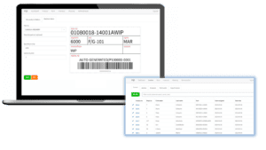
Precision Quality Systems has been doing subassembly and inspection services of plastic fasteners for the automotive industry for many years. ADC worked directly with them to build a robust, but also lightweight, ERP system to help them manage their entire operation.
Interested in learning more?
Our Story
Over the Years
ADC has experienced steady sales, client, employee, equipment and physical growth since its inception in 1996. At the company’s end in 2023, ADC employed over 50 staff members and served hundreds of clients of all sizes throughout the nation. The following provides a snapshot of key milestones in ADC’s history…
1996
Founded
1996
Company formed with 2 founders in Omaha, NE. with Corps of Engineers, Omaha District Geographic Information Systems (GIS), Service Center Contract, and Chippewa County Land Use Department as clients.
1997-2000
Expanding to Eau Claire
1997
infoUSA contracted with ADC to provide point location maps.
1998
ADC expands to Eau Claire, WI and creates corporate headquarters in rented office space at Banbury Place.
2000
Awarded “New Business Partner of the Year” by ESRI.
2001-2005
Set Up Headquarters
2002
Introduced WebGUIDE, a product for counties to serve their GIS data to the web.
2003
Constructed a new 3,600 square-foot office building in Eau Claire near State Hwy. 29 and County Road T.
Created ADZMAR, the automated delivery zone, mapping and routing application for Directory Distributing Associates, Inc. (DDA), which provided a more efficient way to deliver telephone books.
2006-2010
Onwards and Upwards!
2006
Contracted by Army Corps of Engineers to help with Hurricane Katrina efforts. Sent 7 employees between 2006-07 for debris management.
2007
Designated a “High Technology” company by the State of Wisconsin and eligible for Tax Zone Credits.
Provided web-based mapping tool for infoUSA.
2008
Constructed 6,000 square-foot office building with new state-of-the-art server room as the centerpiece.
Reorganized the company into four divisions to ensure diversity, specialization, and to handle future expansion and growth: ADZMAR, GIS Technology, Web Division, Software Development
Launched Elite EXTRA, a new tracking and routing application for automotive part deliveries.
2009
Awarded a $5.5 million Army COE GSC BPA Contract.
Launched EAGL-i, an interactive mapping tool to assist economic development corporations in business development.
Created a new GIS Consultants Division.
2010
Partnership with ADP, Networkfleet, ACDelco.
Partnership with e-Original for electronic signature capture.
Created a new Elite EXTRA Division.
Launched EXTRA’s mobile application, EXTRA ToGo.
Launched MapVis, a geo-selection tool to display your business data.
2011-2015
Going Global
2011
Awarded General Motors ACDelco contract for Elite EXTRA.
Have served clients in 38 states and Canada.
Won Chippewa County Economic Development Corporation (CCEDC) Quadrant 4 Business of the Year and the CCEDC’s Overall Business of the Year.
Attained Silver Partnership status with ESRI.
September 2011 — ADC celebrates 15 years.
Began many strong partnerships with NADA, AAPEX, ITG, Mopar Masters Guild, and CDK.
2012
Released Asset Record ContainerTM online property asset virtual management portal.
Expanded hosting infrastructure through West Wisconsin Telcom partnership.
Created web-mapping application for the Corps of Engineers.
Formed partnerships with Envue Telematics.
2013
Launched WGX Mobile.
Enhanced Elite EXTRA with signature capture, new reporting abilities and iPhone app.
Introduced web portal for Wisconsin Dept. of Natural Resources to protect endangered species and expedite business development permitting processes.
Partnered with Procede and VLC.
2014
Released REDIcomps online property portal.
Awarded $3.3 million Army COE GSC BPA Contract.
Won Eau Claire Chamber Small Business of the Year.
2015
Introduced EXTRA +Telematics.
Landed first European Client.
Received Wisconsin Innovation Award.
Partnered with Redline.
2016-2020
20 Years & Going Strong!
2016
Celebrated 20 year anniversary!
Partnered with Epicor.
2017
Released EXTRA 9.0.
Partnered with Geotab.
2018
Debuted our Delivery Network
We were named ‘Top 10 Logistics Tech Outlook – Routing and Scheduling Solution Providers.’
Partnered with Panasonic and Reynolds & Reynolds.
Added Madison and Milwaukee Offices.
2019
Awarded ‘Innovator of the Year’ by Panasonic.
Uber became a partner and prominent provider in our Delivery Network.
Partnered with Karmak.
2020
Awarded INC Best Workplace
Broke ground on a new hi-tech three-story building to handle growth.
Renovation began on the north and south buildings for a new rec center and wallyball court.
Partnered with LBM LIftoff and Azuga Telematics.
2021-2023
Innovation & Expansion
2021
We celebrated our 25th anniversary and opened the doors to our new office!
Awarded CCEDC’s Business of the Year.
2022
Expanded our offerings in the last-mile space to now offer a full last-mile logistic suite, including 3 products: Routing & Dispatch, Delivery Network, and Returns Automation.
Received an Edison Award for our Delivery Network.
DoorDash, Roadie, and many more providers joined our Delivery Network.
Partnered with Tag Logistics, Business Solutions Partners, and Uniparts.
2023
Elite EXTRA’s 15 year anniversary
Applied Data Consultants/Elite EXTRA was acquired by Epicor Software
Let's talk logistics
Have questions or want to learn more? Contact our team today to discover how Elite EXTRA can streamline your last mile logistics. Fill out the form or contact us from the email or phone number below to start a conversation.
Email Us: sales@eliteextra.com
Call us: 1.888.484.8729
We look forward to working with you!

Please fill out the form:
Stay informed!
Sign up for our newsletter and follow our socials to receive relevant industry insights and updates about our solutions!

